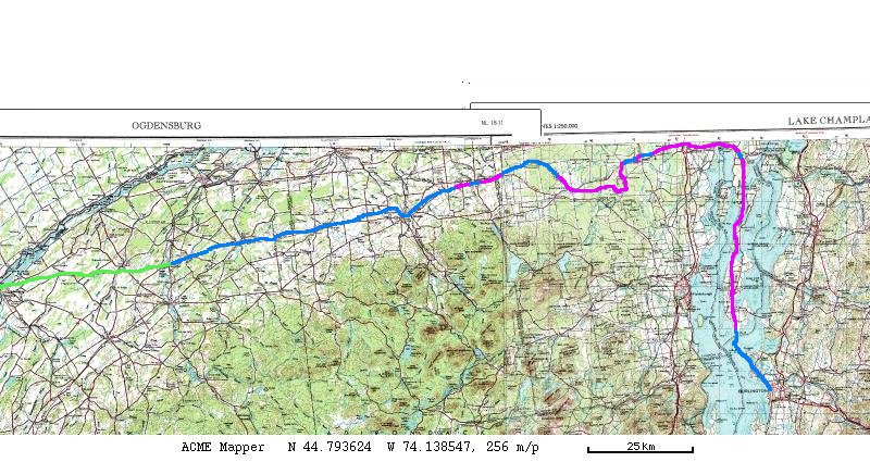
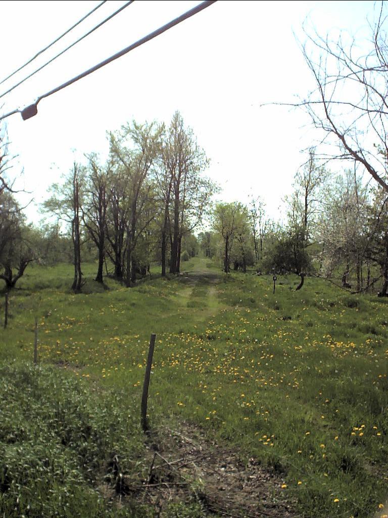
As a long-term project I've been bicycling the Rutland Railroad in Northern New York. So far, I have travelled on the blue line in the image above. The green on the west end is operating trackage, the New York and Ogdensburg. The Rutland Trail comprises the westernmost bit of blue line, and the Island Line the southernmost. There are a few more bits of blue, but the rest of it is brushed over, plowed away, built upon, or posted.
An awesome resource for the Rutland Railroad, although not at all for the Rutland Northern Division, is the Francis Poulin photos. In the early 1960's, after abandonment, and before the rails were pulled, he walked the length of the Rutland system in Vermont, taking photographs as he went. Righteous, dude!
From Ogdensburg to Norwood, the tracks are still in place. They're undergoing maintenance this (2003) spring. You could, in theory, ride the tracks with a Bentley railbike, but it's dangerous and illegal to do so without permission.
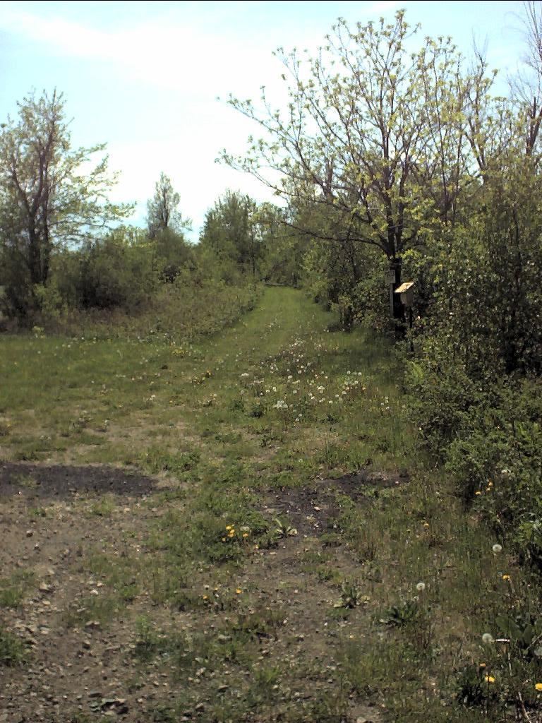
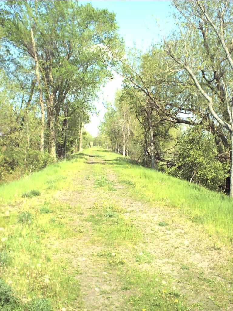
From Norwood to Knapps Station (aka North Stockholm on the map, but nobody calls it that) the railbed is ridable. There's a section between the Norwood-Knapps Station Rd. and Old Market Rd. which is difficult to ride because the bridge over Plum Brook is out. The abutments are still there, and it would be easy to put a wooden bridge in place since it's right next to the road. I rode it, climbed down, jumped across the water from stone to stone, and climbed back up again. Update 10/02: Since the Town of Stockholm has purchased the railbed, they've helped the local ATV club restore the bridge. You can now ride from Norwood to Winthrop on the railbed.
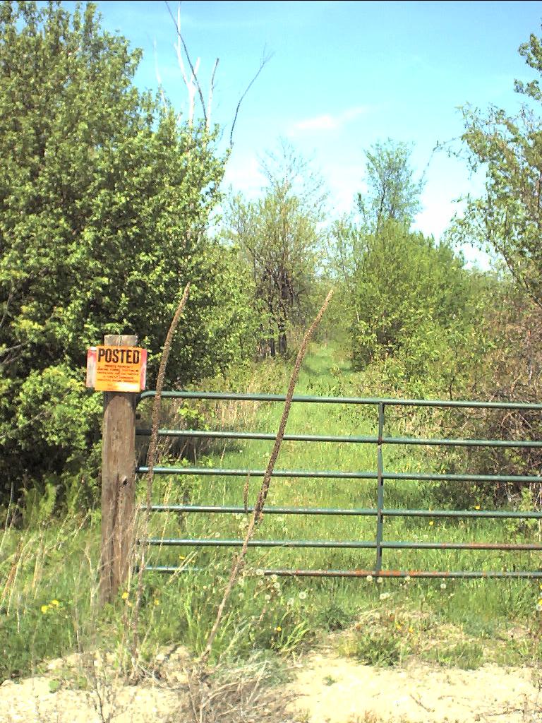
From Old Market Rd. all the way to Winthrop the railbed is publicly owned, and ridable. The Tri-Town ATV club has, with the cooperation and help of the Town of Stockholm, rebuilt a missing bridge. I rode this section 10/12/03, and apart from two bridges where they placed ties parallel to the direction of travel, I was able to ride without stopping. Update 9/07: The last mile or so into Winthrop is privately owned. The previous owner died, and for some reason, the executor of his estate sold it even though the town was interested in buying. The new owner has it posted but not blocked, and Lowell Kelsey, town supervisor, told me that he is okay with recreational use of the trail.
In Winthrop itself, the railbed has been built upon, so you have to go off to one side. Across Rt. 11C is the Agway dealership. When looking for railroad tracks in a town, always start at the Agway dealership. Without exception they were always built next to the railroad tracks. Some Agways have moved (e.g. in Massena), and some tracks have been abandoned (e.g. nearly everywhere), but they always came in pairs.
Winthrop is no exception. Past the Agway dealership is the St. Regis river, and the railroad bridge is out. No matter, you can take the highway bridge and a side road to the Barnage Road end of the bridge for about a mile's detour.
Update 5/08: Harry Dow et al have purchased the railbed between Barnage Road and Hallahan Road. They've posted it as a Nature Trail (but no hunting, trapping fishing, or littering) open to the public. Yay them! Great guys! They've also improved the bridges mentioned in the next paragraph with metal decks and railings.
There's another couple of bridges -- just little things. One of them is obviously maintained by the snowmobilers. There's a sign warning of its presence. Soon you reach North Lawrence, where the bridge is out. You can cross the Deer River on the highway bridge, and get back on the railbed on the other side. It goes past the water treatment plant, not on the topo map. Unfortunately the Coolbrands Plant has posted the ROW past the water treatment plant, and placed a fence across the ROW there, and at the next road crossing. The concern is that erosion from wheeled damage might damage the water treatment plant, plus an abutter to the east complained about ATV users hunting on his land.
I believe it was at this point, at the O'Connell Road, that I was stopped one year by beaver activity. The entire railbed was flooded as far as I could see. I came back the next year, and it was perfectly dry. Either the beaver left voluntarily, or was coerced.
Now we get to the village of Moira. It was a former railroad hub, with a line to Dickinson Center heading south, and two heading north, one to Helena, and the other to Bombay. I've done some research on the the Moira & Bombay. Chris Granger has been researching the Ottawa Division, which went north through Helena and south through Dickenson. None of these lines have been kept open as a right-of-way. Sections are still open, but not the whole. The Ottawa Division is open from St. Regis Falls to Santa Clara as a public road, and a private road through Tupper Lake. There may be an easement on it, but there's also a bridge that's out.
The station in Moira still exists, and is in use as a tavern. Update 9/05: the tavern is closed. The trail continues around the back side of the station, on to Sayles Rd. Beyond that, the trail is fenced off and posted. It's just as well, because the bridge over Farrington Brook is out. This segment of the trail is unusable.
The next town is Brushton. The trail in most of Brushton is built over. The bridge over the Little Salmon River is also out. The east end of the Little Salmon River bridge approach has been built on, so you can't travel on it either. You can pick it up on the north side of Rt. 11. When I travelled this section, I found the railbed flooded and marshy. Not obviously beaver work.
After the next road (Wagner), the railbed is obstructed. It's close enough to the road that the property owners have taken an interest in ensuring that it isn't used. After Garvin Rd., when it heads away from Rt. 11, it's open again.
At this point, the railbed opens up again. It goes through to Bangor Station, which isn't really considered a separate place anymore. It's now Sample's Lumber (Update 8/04:Dwyer's Home Improvement Center closed), which everyone says is in North Bangor. There's no sign of the station anymore. Headed east past then-Dwyer's, I quickly ran into several inches of running water. Took off my sneakers, and waded through it. After about 100' of that nonsense, I came to the beaver dam that was causing the problem. The silly beaver had built his lodge right next to the railbed and was rather surprised when I went wading past.
I made it to within about a kilometer of Wheeler Rd. but got so exhausted from pushing through ice storm debris (this was the summer of 1998) that I had to bail out and walk south through a farmer's field to the road. Next summer, when I picked up the trek at Wheeler Rd., the property owner had cleaned up all that brush so it's open again. I was able to backtrack to the point where I had given up.
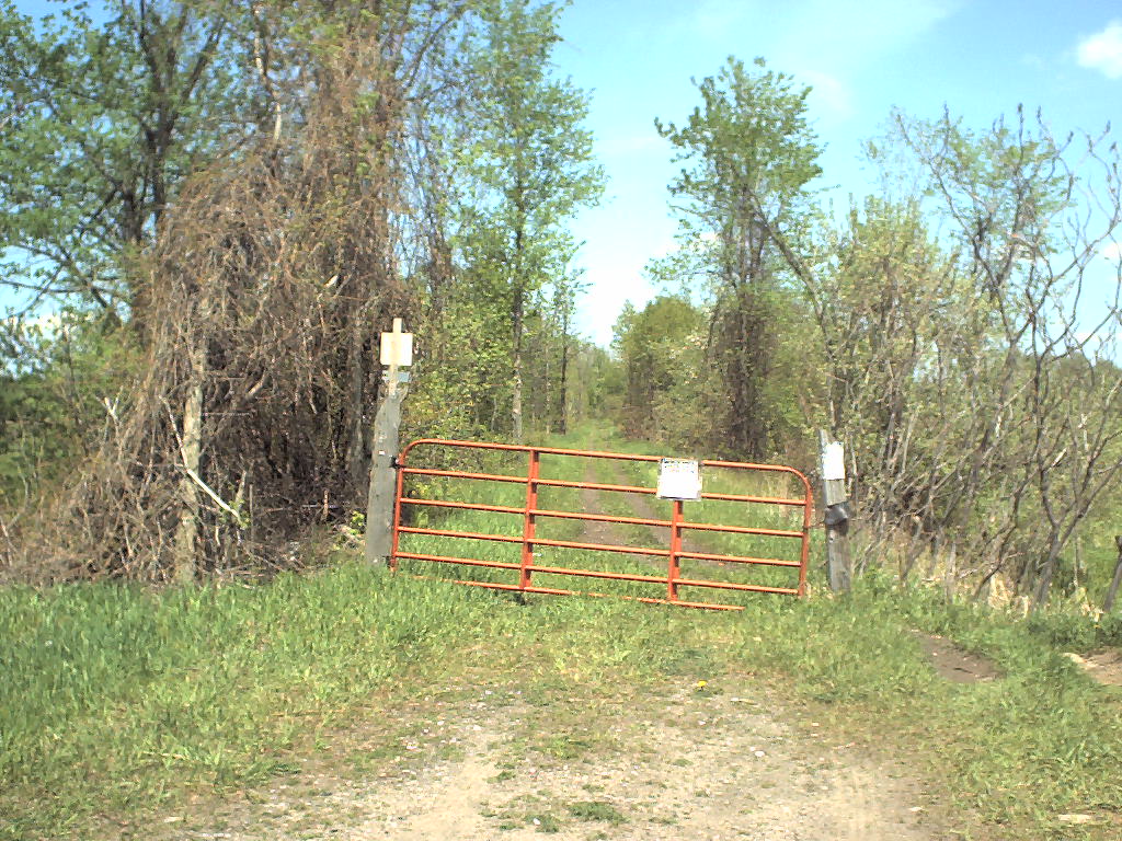
There's a gate across the railbed on the east side of Wheeler Rd. I found the property owner and asked for permission to ride the railbed. He asked me to keep an eye out for three escaped cows who had been lurking in that area. Saw hoofprints, but no cows. The railbed is clear of brush all the way to Rt. 37.
On the west side of Rt. 37, the railbed is choked with brush and raspberries. If you're willing to push through (and you know I was), then you come out behind an automobile repair shop. The brush gets really bad from there on, and I gave up. Rode to the back of the cemetery and yup, still brushed over. Found the side-street that parallels the railroad. Brushed over. And then it turns into an industrial mish-mash of cyclone fences once you get into Malone proper.
You could write a whole web page about the two railroads that served Malone. This isn't that web page. I will say that you can ride on substantial portions of the railbed through Malone. To the west of the river, the railbed has been completely obliterated by new construction. You can see the bridge abutments where it crossed the river. Hugsbugs (Update 8/10: their website has gone away; use my local copy) has some excellent photos of the Rutland train station in Malone. To the east from there, you can go about five blocks, then the railbed runs into a lumberyard, another industrial building, and then a marble distributor. And then you're at Malone Junction. Not wanting to go much farther, I rode to Houndsville Rd. and turned back for home. I rode north from Malone Junction to Canada in 2001. Rode south from Malone Junction in 2000 and 2004.
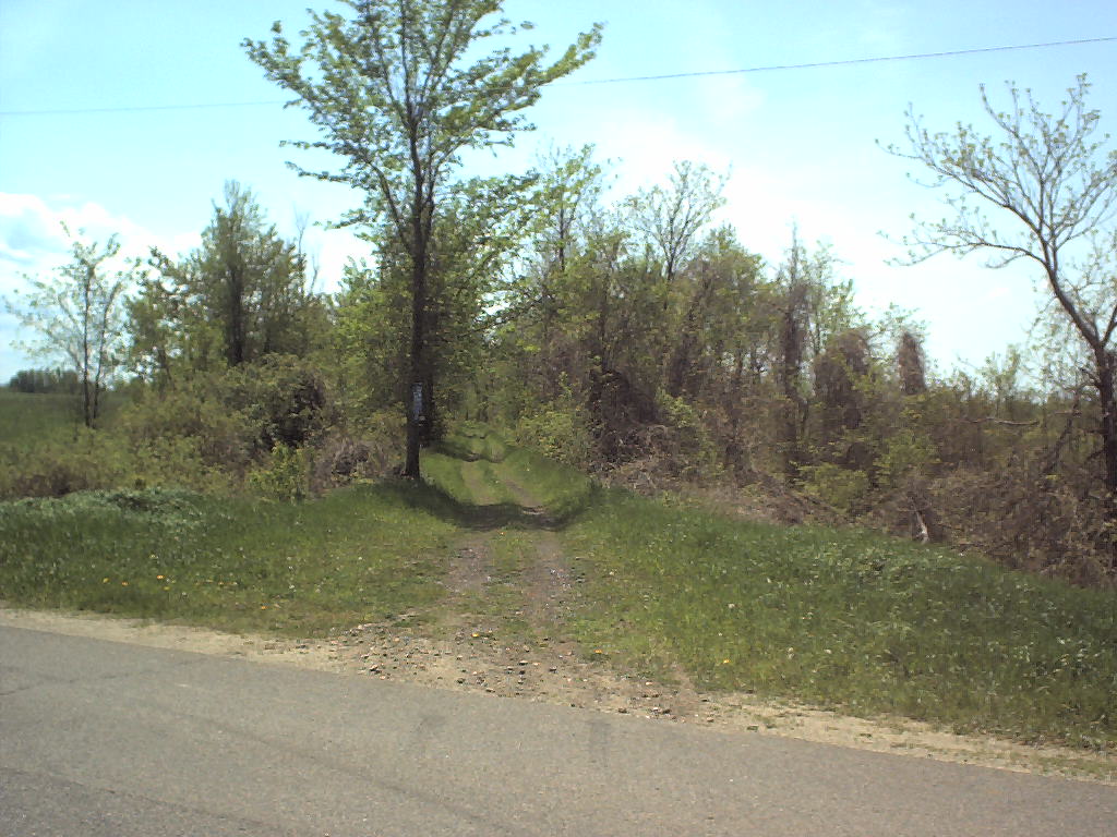
Update 5/28/02:: rode from Houndsville Rd. to Burke. Took two pictures at Houndsville Rd., one west looking back in the direction of Malone and the other east. Yes, the gate is posted, but the posted sign has no legal force since it doesn't have the owner's name or address. The embankment over the Trout River is quite high; in fact remarkably so. You can look down at the tops of the trees at the bottom.
I had no trouble reaching Rt. 11. Took a photograph back west. The topo map is mis-registered at this point, but the image version is registered properly. I got a little lost crossing Rt. 11, and followed the snowmobile trail instead of the roadbed. Had to go through a bunch of mud pits and follow a deer trail along a fence line in a NW direction. Rejoined the railbed (looking west), and followed it to Muzzey Rd (looking west). A Mr. Muzzey lives in the first house on the right heading SE on the Muzzey Rd.
Crossing Muzzey Rd., there's a posted gate. The owner's name and "Muzzey Rd." are on the sign, so I rode down Muzzey Rd. to see if I could find his house. Nope. Oh well. I rode east about 0.6 miles until the brush got too thick. I could still push through it, but I didn't have all day as I had to be back in Potsdam for a handbell rehersal. Turned around and came back. Too bad, because I probably would have found clear going had I pushed on a little bit farther. Rode back to Houndsville Rd., and got the truck.
Drove along Finney Rd, and turned right onto a two-lane county highway. Found the railbed (couldn't miss it) and snapped a picture west and east. I bicycled the railbed west. Doesn't that railbed look sweet? A little ballast, a few ties, and some rails, and you'd be back in business. I didn't quite get back to the grown-over area. I stopped at a gate even though the railbed continued as grass. I'd run out of time and was dead tired.
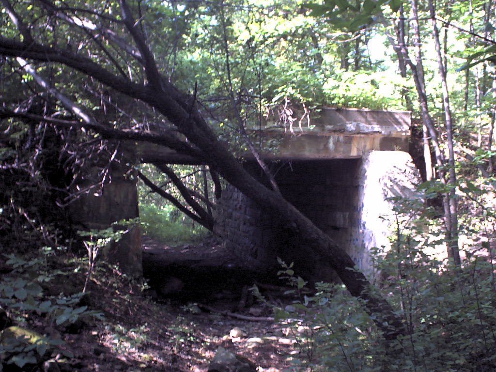
Before going home, I drove down the Pikeville Rd. the few hundred feet necessary to find the railbed facing west and east. And I couldn't resist peeking in the Village of Burke at the railbed. It's ridable in both directions, with a nice old stone arch bridge over the Little Trout River.
Update 8/29/03:: Rode through Burke today. Parked at the St. George Cemetery, and hopped on the railbed just on the south side of the cemetery. Nice riding, once I got past a 50' long puddle. Going over the Little Trout River, there's no sign that you're going over a river. You can look down and see it, but you can't see any sign of the stone arch from the top.
Got into Burke easily enough. Crossed Depot St. No sign of the depot. Had a little bit of trouble finding the railbed going east out of town. Don't think the entrance to the railbed is really where the railbed was. Nice riding from there to the next road, and a little bit past. Got to a farmer's road, and the 4-wheeler trail headed off to the right. The railbed was grassy, and ridable, but there were fallen trees which made it rather a pain. Gave up, and rode out to the highway on a field border. Worse yet, the railbed has been destroyed farther to the east. The farmer plowed it into nonexistance.
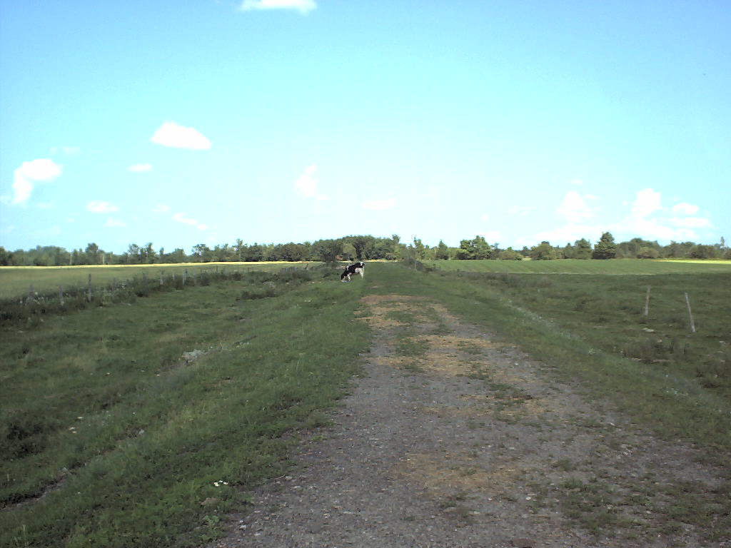
Rode past that intersection (the railbed went about ten feet north of the intersection). Noticed that the railbed ran through a cow pasture and was open. Stopped at the farm and asked about ownership and permission. It was theirs, and he gave it. I rode through the cow pasture and had a few curious cows amble up. Actually they came running up. It's rather alarming to see a dozen cows running at you! Fortunately, my bicycling speed was faster than their "I'm curious about this" speed and I left them behind without particularly trying.
Made it down the railbed about a mile, and ran into a fence and brush. Lots of brush, with no end to it in sight. The property owner had bulldozed mounds of dirt in the right of way (fact) to make sure nobody used it (speculation). I pushed my way down it about a quarter mile, but gave up. It's too slow and exhausting to do much of that. It's too bad the railbed isn't open at that point. It's quite far away from anyone and anything, and users wouldn't intrude on anyone's privacy. Oh well, can't second-guess a land-owner's desires even though it leaves a huge chunk of back-woods railbed unusable.
Closer to Chateaugay, on the west of the St. Patrick's Cemetery, the railbed is part of a cow pasture. The cows keep the brush down, but the electric fence makes using it unattractive. I took a bye on that section, parked the car just south of the cemetery, and hopped on the railbed. There's quite obviously an active 4-wheeler club keeping this open. They have it nicely marked with signs of all sorts.
The railbed crosses the Chateaugay River on a 130-foot-tall fill. Quite amazing to be that high above the surrounding territory. Next we come to an interesting pair of features. Notice the curve? That's where a branch line went up to High Falls. Notice the north/south fence line north of the railbed? That used to be a road, and beneath the railbed is a highway tunnel (picture looking north). That road is drawn in the 1890's 15' topo map as stopping at the railroad, but that's not likely given the tunnel. Indeed, it appears on-site as if the road continues south beyond the railroad. I didn't explore to see quite where the road ends.
I rode the railbed up to High Falls. At one point I could hear High Falls quite clearly, although I couldn't see it. The railbed is open as far as the road that goes down to the gauging station. It continues on the other side of that road, however it's all brushed over.
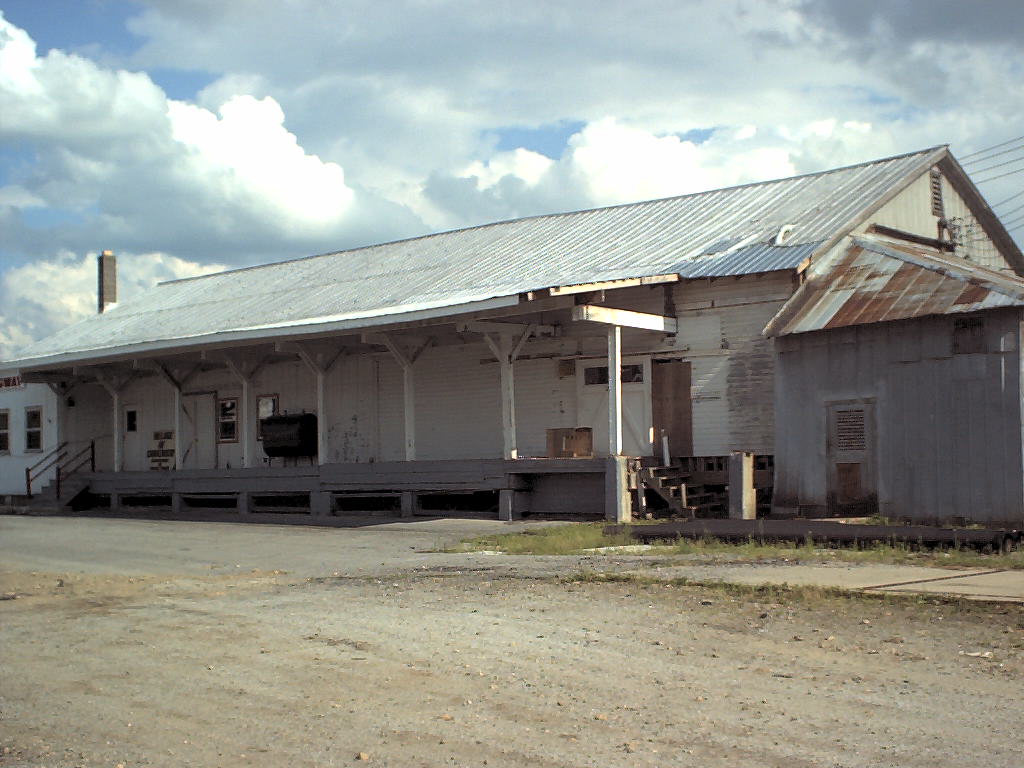
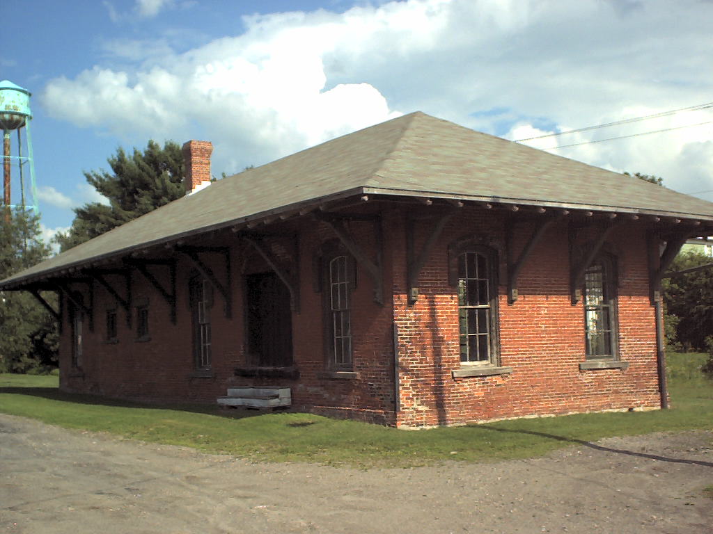
In Chateaugay, next to the railbed, you'll find the old Agway store! Nelson's Theory of Agway/Railbed Confluence proven again! It's now being used as the town highway maintenance offices. There was a railroad yard which makes a nice gravelled surface for the highway department. A little east of there is the railroad station. The station has an Existing Stations entry. I like my own picture of the station better. Plus, there is now a railroad car behind the station!
The railroad obviously served the McCadam Cheese plant in Chateaugay. You can see where the railroad went out the back of the plant, but there's a fence blocking the railbed, and in any case, the farmer has plowed out the railbed on the other side of the Marble River fill. East of that, the railbed runs too close to the road for anyone to bother keeping it open. The first open place I could find was on the Lost Nation Road. It's open (but gated and posted) to the west, and to the east. The sign to the east says "Gate must be kept closed before Dec 14th". The railbed is kept in very short grass, so I expect that the property owner is happy to have snowmobiles but doesn't want ATVs on his land. It seems to be open from there straight through to Churubusco (it is; see next two paragraphs)
Longest ride this season for me: 35 miles. Felt like a wimp on the way back because I was riding into a 15 mph wind, and hit a bonk. Ouch. But the way out was simply marvelous, riding with the wind. Hit the Rutland railbed shortly after crossing into Clinton County. I rode all the way from Chateaugay because I wanted to make the ride longer (mistake), and because I wasn't sure quite where I could get on the railbed. There is practically nothing left of the railbed all the way from Chateaugay to the Clinton County border, because it ran so close to the highway. In many cases it ran straight through people's back yards. No way they would tolerate use of it as a trail. It could only have survived if somebody had bought it and preserved it as a trail, but nobody was doing that in 1963.
Going east from Chateaugay, the first point at which the railbed is still a right of way is at County Line Road. Unfortunately, it's also gated and posted no trespassing. I went to the next road, CR 9, and found it gated and posted on both sides. Got the owner's name going east, and went back to the convenience store at the corner of US 11. Called the owner, Richard Decoss. Too bad -- not home. I thought I'd ask the store clerk if she knew him. She was nonplussed because .... he's the owner of the store, Dick's Country Store and Music Oasis, and he was over in the other room. Asked him for permission and got it, no problem!
As an aside, the Music Oasis sells Gibson guitars, unsurprisingly. Surprisingly, Chateaugay is the birthplace of Orville Gibson!
I was able to ride from there straight through to Churubusco. It's labelled as snowmobile trail 8C. In the hamlet, the railroad went through people's front yards, so they went to the effort of obliterating any trace of it. No problem since there's a road parallel to the railbed about 70' to the north. Hopped back on the railbed east of town, which is now a full-fledged dirt road. It's used to get to a stone quarry which used to have its own industrial track. East of Clinton Mills, the railroad goes through a short (10') cut. Somebody is mining the stones from the edges of the cut, putting them on pallets and shrink-wrapping them.
The railroad heads due south at this point, continuing on through field, forest, and wetland. Lots of wetlands. Goes about 30' over a small creek on a fill. Good thing it was a fill and not a bridge, although .... I'll bet that if you dig down into the fill, you'll find that it was originally a wooden trestle. As the trestles got old, the railroads would build a culvert over the stream, and use dump cars to bury the trestle. Cheaper and less disruptive of railroad operations than building a new trestle.
At Bull Run Road, the other side of the road was posted "No ATVs", and was severely grassed-over. Somebody mows it; you can see that, but I think they're associated with the snowmobile club. I went in a little ways, since I wasn't riding an ATV, but the grass got too tall for me beyond Brandy Brook, and I could see that the railbed was brushed over beyond that. So I turned back. I took a look at Brandy Brook to see if the bridge abutments had any USGS bench marks, and found one on the north side of the west abutment.
Turned around and headed home. On the way, I ran into Ellenburg Depot to see if the southern end of that section was accessible. No hope. The depot itself is an active business strongly signed "No Trespassing. All Visitors Report to Office." It's likely that they're trying to discourage ATVers or snowmobilers from attempting to use the railbed. Other than the depot being an obvious depot (and on Station Road, to boot), there is no sign of the railroad. The highway crews took out the north abutment of the bridge over US11 and the Great Chazy River (I remember going underneath a railroad bridge there some time prior to 1975), but the south abutment remains as a beautiful cut stone structure.
I turned and went home, uphill and upwind.
The Rutland railbed is completely overgrown on the south side of the river. There is essentially no sign that a railroad ever went through the area all the way through Dannemora Crossing, Forest, Irona (although there are ruins of rail-served buildings there), Altona, and Woods Falls. Finally, in Mooers Forks you can see several rail-served buildings, and on the north side of town some snowmobilers and ATVers have been able to carve out a few miles of the railbed.
I was able to ride that section in July of 2008. The railbed is mostly sand through there; a bit difficult bicycling. Just before getting to Mooers there's a gate across the railbed. Turned back rather than trespass.
On the other side of Mooers it becomes overgrown again. The bridge over the Great Chazy River at Twin Bridges is out, and somebody has used the railbed as their driveway. Very little of the railbed is open between Mooers and Rouses Point. The I-87 crossing is still a bridge, but that's mostly because there's a road right next to it. When they rebuild that bridge (eventually) they'll likely move the abutment closer to the road.
I'm probably done riding the Rutland, because most of the rest of it is overgrown. Most of the Rutland railbed in the Champlain Islands is built on or overgrown. The State of Vermont owned the entire thing shortly after abandonment, but didn't think anybody would ever want it as a trail, so they sold it off. Now they're trying to rebuild it as a trail. A section east of Alburg is not gated, built upon, nor brushed-over. It's off the end of the Alburg Industrial Park. Seems not to be an official trail since it turns into someone's driveway on the south end.
The southernmost section, from Burlington out on the causeway, has been reconnected; mostly. The causeway is broken at the northern end. In the summer on some days a local bicycle advocacy grou runs a ferry across the gap. Some of the railbed in Colchester got built on, so the "rail trail" uses village roads. They call it the Island Line (history). UPDATE 8/11 Due to the spring flooding which damaged the causeway, portions of the causeway are closed, and the ferry is not operating. Repairs are being contemplated and funding collected. See their website for more information.
Also see these blog postings: Lake Champlain causeway, Colchester and Burlington (7/06) Chateaugay to Ellensburg Station (9/06), Mooers Forks and Mooers (7/08), about two miles long, Alburg and south (7/08), about a half mile. East of Mooers is also open (10/12), and the northern part(10/12) of the Island Line is also a public trail.