|

Copyright © 2001-2006 Arthur John Huneke
ALL RIGHTS RESERVED
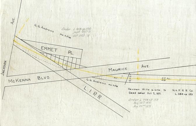
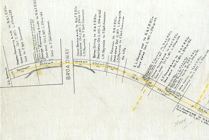
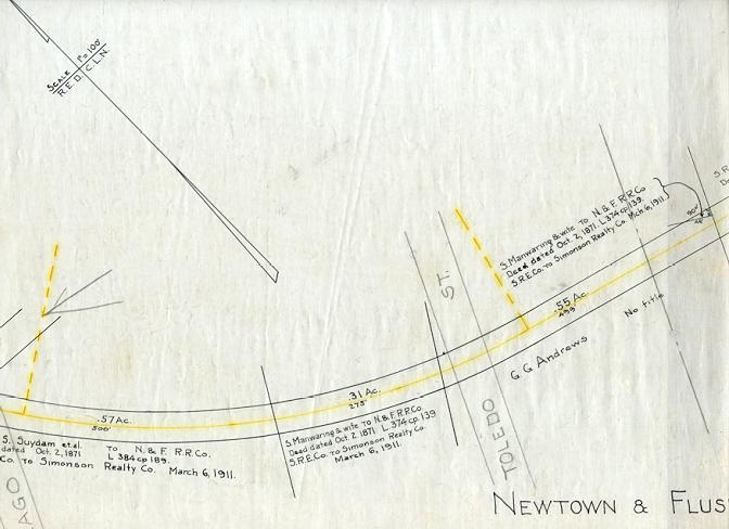
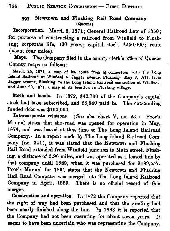
| THE NEWTOWN AND FLUSHING RAIL ROAD
NEW MAY 24, 2004 - Revised January 24 and 25, 2006 |
|---|
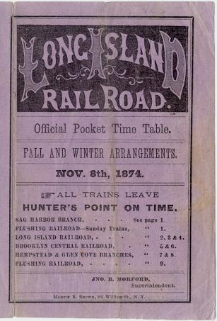
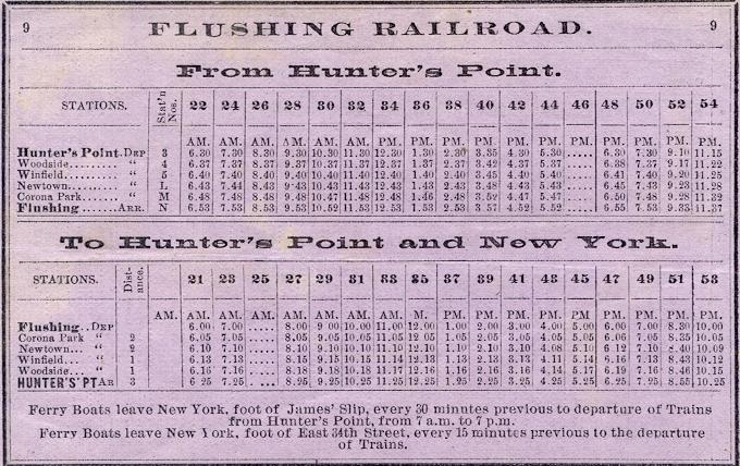
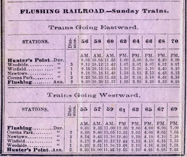
| "FLUSHING RAILROAD" ON THE ABOVE TIME TABLE REFERS TO THE NEWTOWN AND FLUSHING RAIL ROAD WHICH THE LONG ISLAND BUILT, OPENED ON NOVEMBER 10, 1873, AND OPERATED FOR ONLY TWO AND A HALF YEARS. THIS ROAD WAS KNOWN AS
|
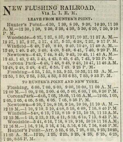
| THIS SCHEDULE FROM "THE LONG ISLAND TIMES" OF JUNE 4, 1874 REFERS TO THE NEWTOWN AND FLUSHING RAIL ROAD AS THE
 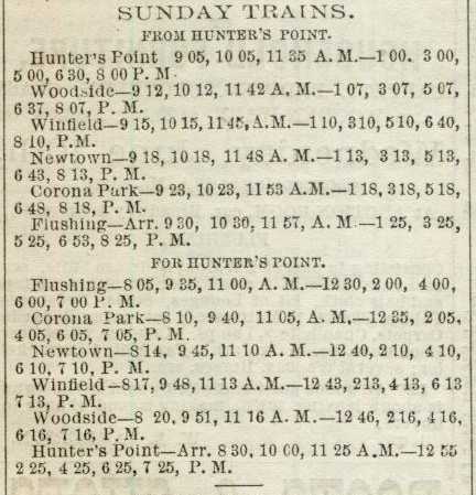
 
THIS AD FROM THE SAME FLUSHING NEWSPAPER REFERS TO THE "NEW RAILROAD TO HUNTER'S POINT" 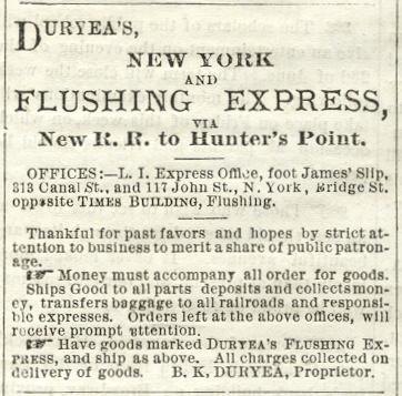
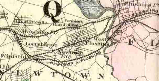
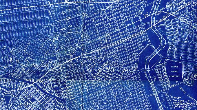
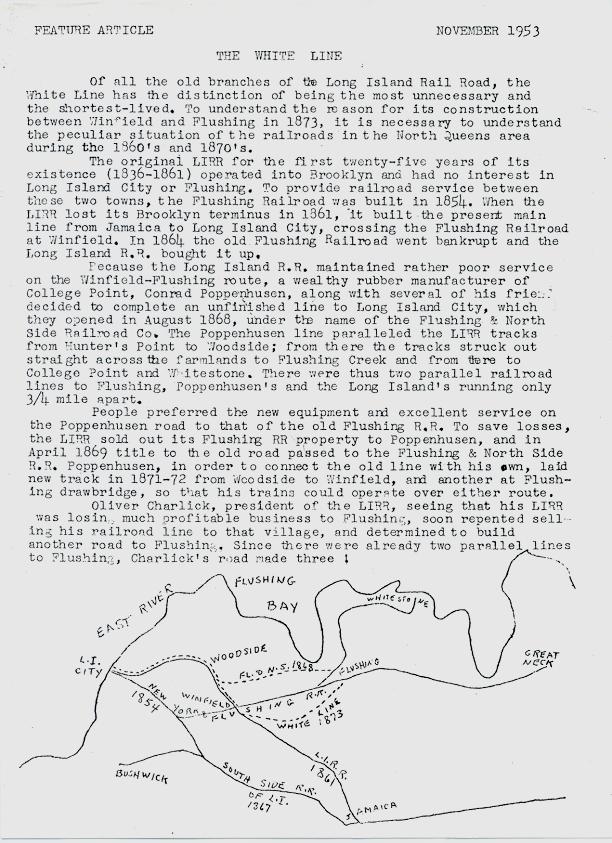
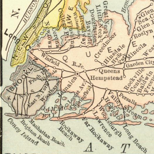 SITE VISITOR AND FRIEND, RAY RENCHER, COMMENTS ON THE 1924 MAP BELOW: "Your recent update includes the LIRR Corporate History Blueprint. which depicts the route of the White Line. I don't believe it's accurate at least in the area between Broadway, just North of Queens Blvd and points East. From Broadway, the line climbs a very steep hill crossing 90th St. and 51st Ave intersection, then crossing the intersection of 92nd St and 50th Ave, then crossing Junction Blvd at the Corona Ave intersection, then moving East through Corona to Flushing on a route far, far North of the one described in the Feature Article and on the attached 1873 map of Newtown (scroll to Newtown.html). The White Line follows a route just South of Justice Ave to a point East, where today it would cross 90th St, bisect Newtown Athletic Field and follow closely 57th Ave to Corona Park where in would turn Northeast to Flushing." |
