I couldn't find much information on the web about the Oswego County Recreation Trail, so I called the county office of tourism and asked them. They gave me some information about the trail which I am paraphrasing here.
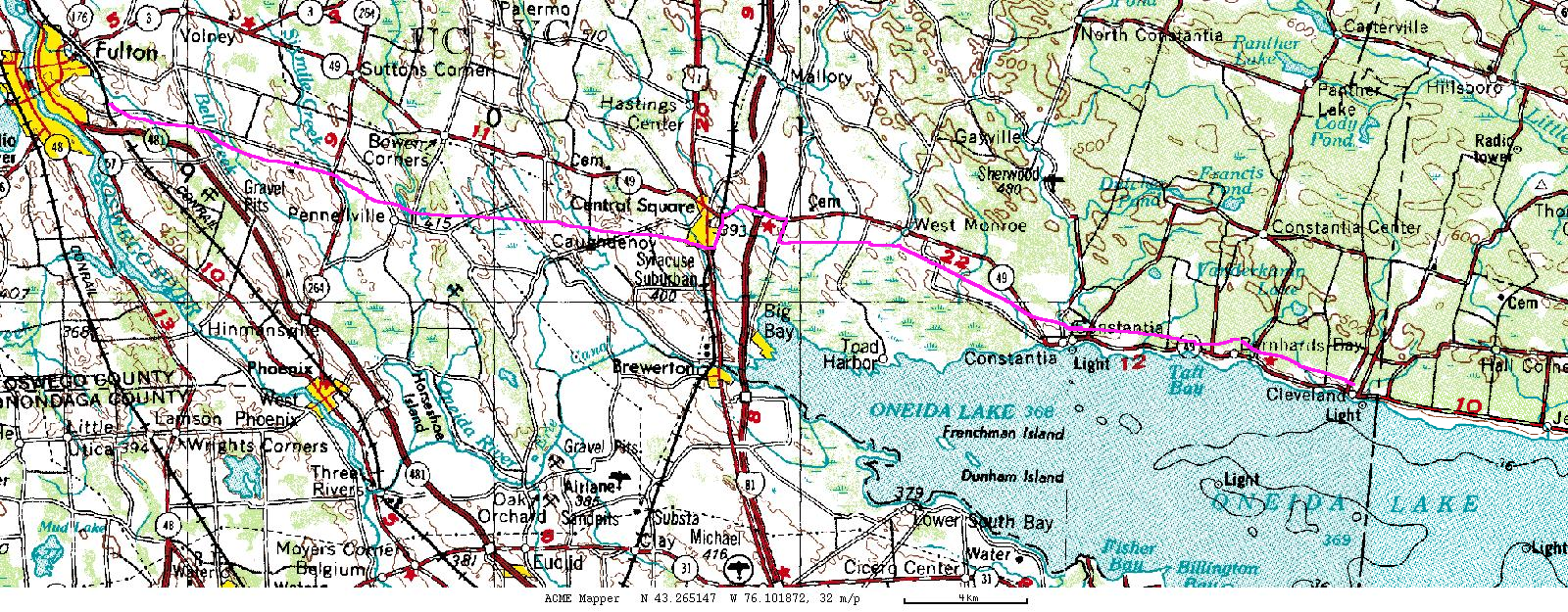
The Oswego County Recreation Trail is actually two trails, named as one. It follows (they follow) the route of the New York Ontario & Western Railroad, abandoned in 1957. The west portion runs ten miles from the city of Fulton's Maple Avenue to the village of Central Square, just short of Interstate 81. I81 was built after the NYO&W was abandoned, and nobody was thinking of linear parks at the time. No provision was made to preserve the right-of-way. In other locations, the highway bridge over the railroad, or the railroad bridge over the highway has been preserved, but NYO&W had no bridge at that location.
To get around I81, you must travel on roads through Central Square. North on Route 11, west on Route 49 across I81, and south on County Route 37 takes you back to the trail. The trail is actually ridable to the west, but it dead-ends in a removed railroad bridge over a creek. Once back on the trail, it is sixteen miles to Cleveland and the Oneida County line. The right-of-way continues as a privately owned trail open for some uses.
The trail has not been resurfaced except in a few eroded spots. The railroad had ballasted with crushed rock, which remains the surface of the trail. The trail crosses many steams using the original railroad bridges. They have been decked over with steel decking. Any road which crosses the the trail may be used to gain access to the trail. Convenient parking is available at County Route 6, south of Fulton; on Toad Harbor Road, off Route 49, near Three Mile Bay; and in the village of Cleveland on North Street.
I have four maps of that page. The first is below and is a thumbnail for a larger map which you can get by clicking on it. The second map is a Google Maps mashup called "ACME Mapper". The third map is also a Google Maps mashup, but it displays the route of the trail on the railbed (and only on the railbed)